-f7eca.png)
We offer Comprehensive Takeoffs and Detailed Estimation Services with 100% precision. Our highly skilled estimators use modern techniques and technology to provide cost-estimating services that enhance the client’s bid-winning ratio.
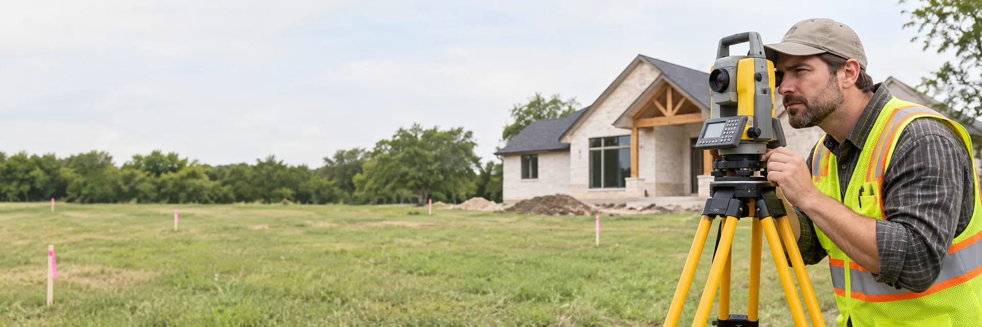
Land surveyors measure and map property boundaries, structures and terrain. Homeowners hire them to find property lines, plan fences or additions, prepare site plans for permits and resolve boundary questions.
Common land surveying services include:
Hire a land surveyor before building a fence, addition or ADU near a property line, when buying land or when a lender, title company or permit office requires a survey.
Rather tell us about the job and have pros reach out? Find Pros
-f7eca.png)
We offer Comprehensive Takeoffs and Detailed Estimation Services with 100% precision. Our highly skilled estimators use modern techniques and technology to provide cost-estimating services that enhance the client’s bid-winning ratio.

Award Surveying, Inc. (A-Ward Surveying) is a land surveying firm serving the Greater DFW area—including Tarrant, Hood, and Parker counties—providing land title, boundary, subdivision, construction staking, exhibits, and topographic surveys with an emphasis on accuracy, timely delivery, and reasonable pricing; Award Surveying, Inc. was founded in 2003 by Paul Ward, builds on over three decades of surveying experience, adopts new technology and staff training to maintain high professional standards, and positions the company to deliver reliable, quality survey products for homeowners, developers, attorneys, lenders, and contractors (source: A-Ward Surveying — Contact / About).

Barrow Land Surveying, Inc. is a Fort Worth–based land surveying firm (Registration Firm #10183700) that provides comprehensive surveying services for residential and commercial construction projects, including construction staking, form and slab elevation surveys, title and boundary surveys, drainage and topographic surveys, tree surveys, FEMA elevation letters, final surveys, as-built drawings, and drone surveying; Barrow Land Surveying uses Trimble GPS systems, robotic instruments, and Carlson Survey software to produce precise drawings and supports clients with secure online payment and project support from its Fort Worth office.

Datapoint Surveying & Mapping is a San Antonio–based engineering and land surveying firm that combines experienced technical staff with advanced geospatial technologies to provide land surveying, GIS & mapping, and UAS/drone services across markets such as oil & gas, renewable energy, transportation & utilities, government, and commercial development; Datapoint Surveying & Mapping delivers ALTA/NSPS title surveys, boundary and topographic surveys, construction staking, pipeline and route surveying, LiDAR and photogrammetry products, asset database solutions, and engineering support from multiple Texas offices (including Fort Worth, Odessa, San Antonio, and Sulphur Springs) while emphasizing accuracy, scalable operations, and timely data delivery.

G4 Geomatic Resources (G4GR) is an authorized Leica Geosystems distributor and full-service supplier for surveying, construction, reality-capture, and public-safety professionals across Texas and Oklahoma; G4 Geomatic Resources provides sales of GNSS/RTK and total station equipment, 3D laser scanners, field supplies, repairs and maintenance, hands-on product demos and training, and local solution centers with delivery and technical support in Irving (DFW), Austin, Houston, and San Antonio, built on decades of combined industry experience and a focus on service, training, and trusted manufacturer partnerships.
-bf7dd.jpg)
Sands Surveying Corporation is a woman-owned, registered and licensed land surveying firm headquartered in Highland Village, Texas, that has provided professional land and property surveying services across the Dallas–Fort Worth region since 2002; the company offers engineering design surveys, construction staking, topographic surveys, ALTA/NSPS title surveys, property and boundary surveys, deed research, GNSS (RTK/static) work, final platting, and related services using Trimble GNSS and robotic equipment, emphasizes accuracy, regulatory compliance, and long-term client relationships, and provides free estimates and regional contact options including phone (214) 919-7883 and the email above (source: https://ssctx.net/contact/, https://ssctx.net/about/).
-e59e4.png)
Texterra Surveying is a surveying company serving the Dallas-Fort Worth (DFW) area, dedicated to providing high-quality surveying services with efficiency and professionalism. The company offers a range of surveying solutions including topographic surveys, subdivision platting, ALTA surveys, as-built surveys, and drone mapping. Texterra Surveying prioritizes customer satisfaction and timely communication, ensuring that client requests are handled promptly and questions or concerns are addressed. The company is committed to delivering accurate and reliable surveying results to support various land development and construction projects.

Wier & Associates, Inc. is a professional engineering and land surveying firm with offices in Arlington and Plano, Texas. The company provides consulting engineering, land surveying, and land planning services, serving a diverse range of clients across the region. Wier & Associates is committed to delivering high-quality, precise, and reliable solutions tailored to meet the unique needs of each project. With a focus on technical expertise and client satisfaction, the firm supports development and infrastructure projects through comprehensive planning, surveying, and engineering services. The company holds Texas Engineering Firm and Land Surveying Firm certifications, underscoring its professionalism and adherence to industry standards.
Find Pros
Tell us what you need and connect with up to 5 service professionals.
A land surveyor researches records, measures the property in the field, locates or sets boundary markers and prepares maps or plats that show boundaries, structures and features.
Common reasons include installing a fence, building an addition or ADU, resolving a dispute with a neighbor, subdividing land, buying property or meeting lender, title or permit requirements.
Land surveyors are licensed by the state, so confirm the license. Ask which type of survey fits your needs, what deliverables you will receive and whether corners will be marked in the field.
Cost depends on the type of survey, lot size and terrain, the availability of records and existing markers, vegetation, travel and the deliverables required.
Gather your deed, previous surveys and plat maps, unlock gates and secure pets. Tell the surveyor why you need the survey so they recommend the right type.